
Geocoding and Reverse Geocoding
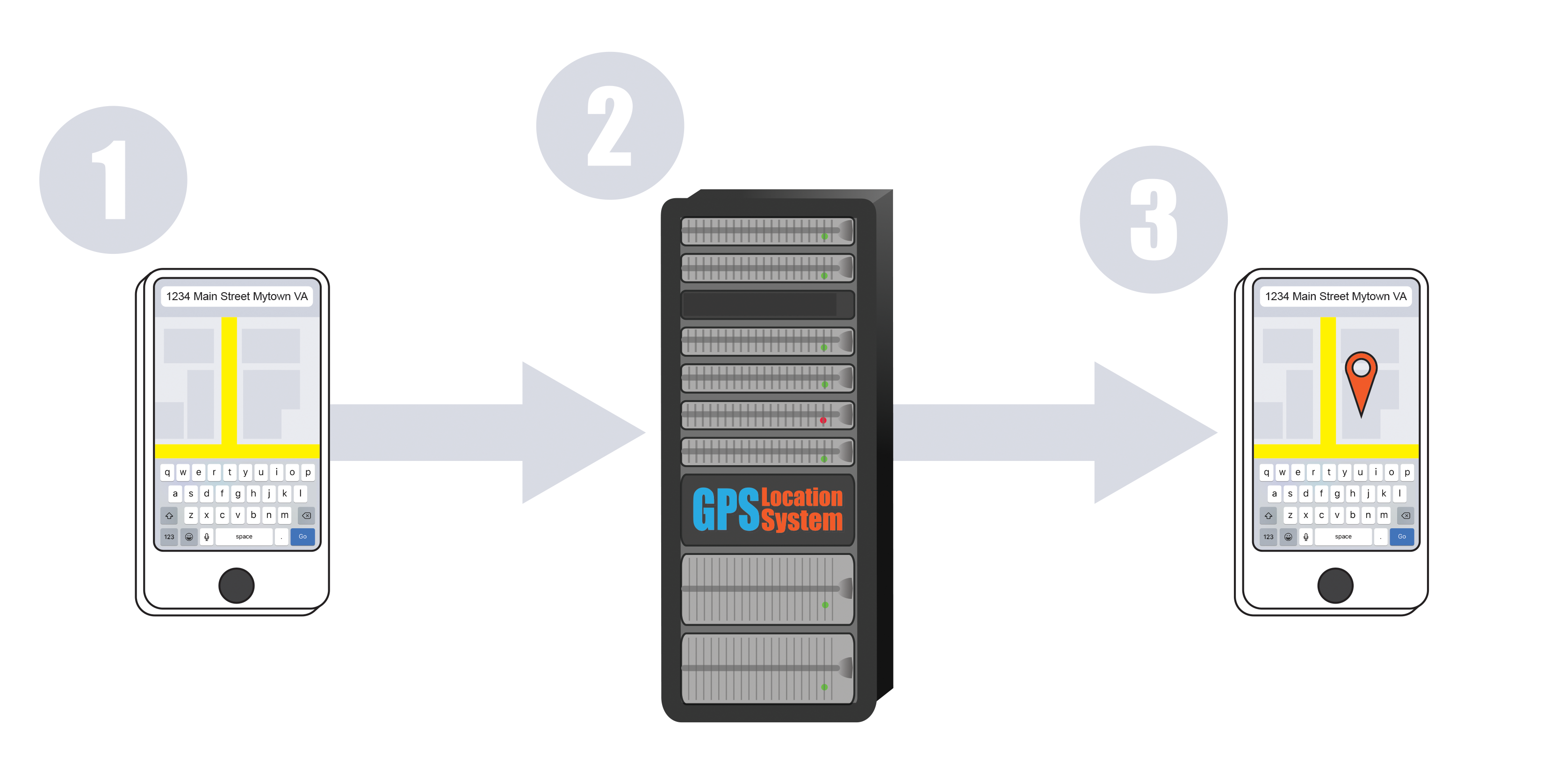
Geocoding is the process of taking the description of a place, such as a postal address, and converting it into coordinates (such as latitude and longitude) that can show you the position on a map or the earth’s surface. Once you’re able to pinpoint the position on a map, you can determine all sorts of information about the place such as nearby points of interest, legal and real estate boundaries, tax data, and road and routing information.
There are numerous systems that can be used to locate geolocation data. Some systems are based on latitude and longitude, but other reference systems, such as the Military Grid Reference System (MGRS) or the U.S. National Grid system can also be used. Other systems are based on addresses, which can express data in a variety of styles and formats, including street intersections, house numbers with street names, and postal codes.
What can geocoding be used for?
Geocoding can be used for data analysis, business and customer management, mapping, or distribution management. Geocoded addresses can be spatially displayed on a map, or they can be displayed in a list format based on certain address parameters. The methods used will depend on how you plan to analyze the information. One common example of using data for analysis is using address locations to plot crime data on a visual map allowing investigators to use the imagery to recognize patterns within the information.
Customer data management
Geocoding is an integral part of managing your customer data. When you have a database of information on your clients or prospects, most (or all) of your records will contain address data for each record. You may also have other information such as buying habits, past engagement, or social media interactions. You can integrate your geocoding data and your customers' information and create a map of their locations, allowing you to develop precisely targeted marketing strategies, produce maps and directions, or assign website visitors to the nearest brick and mortar locations. The geocoded locations of your customers can be invaluable data.